I like running long distances. But I don’t like running in the city. I love the mountains where the air is cleaner, the terrain offers natural interval training, the birds provide the music, the views are amazing and the surface is more gentle on my knees, ankles, and feet.
It can be very complicated to find good places to get your running fix in almost any big city, anywhere in the world. Luckily, Cali is different…
Tres Cruces
For most foreigners, and even locals, the only trail that Cali has, is the hike up to the Three Crosses. I love this hike / run too. Nothing beats the banana bread and fresh orange juice on the top. But it can get awfully crowded. And it’s also quite short. Bragging aside, I went up and down 4 times in 3 hours.
The secret to this trail is on the backside of the mountain, an area known as Tres Tetas – the three tits. Once on the top, instead of heading back down where you started or next to the police station, try following the road down that the cars use. From there, you’ll spot several little trails heading into the bush – all of which are awesome places to get lost and explore the three mini peaks. Worst case, you’re never more than 10-15 minutes from the city. If you end up on that side of the mountain, you’ll hit the paved road around the Chipichape shopping center.
Another option, when coming up the main trail with the crowds, is turning right once you hit the first plateau. Turn where the police have their horses, just before the next climb begins. You’ll pass a house with some angry dogs and then just follow the trail that runs sideways along the mountain.
Ventiaderos to Felidia and Saladito via Pichindé
One of my favorite trails is actually a downhill mountain bike trail. But instead of running down, I prefer running up. The easiest way to find the beginning of the trail is to start by the Cali Zoo and continue west on Carrera 1 Oeste until the road splits. The paved road continues up the mountain and a dirt road with a tiny bridge crosses the river. Follow the dirt road and right after crossing the river you’ll pass a house on your left side. Just after the house a green gate on your left side signals the beginning of the trail up the mountain. Just hold left the entire way and you won’t get lost.

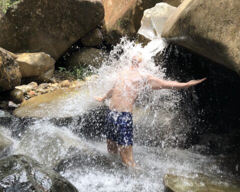
Reaching Ventiatederos where the downhill bikes begin their ride will probably take you 45-60 minutes. This is a good place to hydrate and either run back down, take the chiva bus or jeep down to Cali or continue down the dirt road to Pinchindé – a cute little village in the mountains with fresh air and a crystal clear river, perfect for a swim. Reaching Pinchindé will probably take around 20 minutes and if upon arrival you’re short on time or energy you can catch a jeep or bus back to the city from here.

From Pinchindé, you can continue to La Leonora also on a dirt road. Shortly after La Leonora, the road becomes paved and leads you to Felidia and then Saladito which is KM12 on the road towards Buenaventura. Buses to Cali pass on the main road all the time. The total distance from the Zoo to Saladito is about 26 km and will take about 3-4 hours depending on your physical condition.
Aguacatal to KM18 via La Castilla
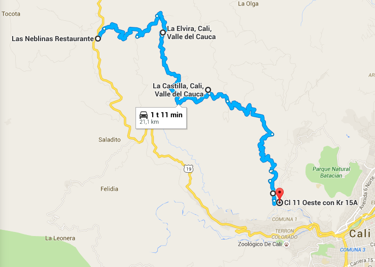
On the opposite mountain, in barrio Aguacatal, there is a dirt road with very little traffic that will bring you all the way up to KM18 via La Castilla. This run is a climb all the way to the end and about 22 KM in total.
The tricky part is finding the beginning. Continue on Calle 11 Oeste through Aguacatal, pass the fire station until you arrive at this point (see picture below) from where you will follow the concrete trail up the mountain. After passing a small water stream you will reach an egg distribution center. Follow the road to the right, twisting around the distribution center. Just after passing it you will reach the road up to La Castilla on your left side. After La Castilla, which is a good place to buy water and snacks, comes La Elvira and then KM18.

Just after La Elvira the road will split. Take a left and you’ll get to KM18. Take right and you will end up in Dapa – another potential run that I have yet to make.
KM18 is your destination and landmark on the road towards Buenaventura. It’s like a small village and there are lots of little restaurants. From here you may take a bus back to Cali. They pass all the time.
Pance
Pance is an outdoors lover’s paradise. It’s located in southern Cali is part of the Farallones national park. The area is packed with trails, rivers, waterfalls etc, perfect for hiking, running and playing. The North Face Colombia trail marathon takes place here every year. Famous local peak hikes include Pico Loco, Pico Aguila, and Pico Pance. It’s a trail lovers paradise.
The options are too many for me to list them here. I suggest that you go with someone who knows the area well, or you could bring a GPS and explore the mountains. Whatever you do, just don’t go alone before you’ve gained familiarity with the area.
La Virgen to Club Campestre
From the Virgin statue behind Cristo Rey by the Yanaconas recreational park, there is a trail that will take you all the way down to the Club Campestre in southern Cali and spoiling you with amazing views of Cali along the way. I have yet to run this trail myself, but a friend of mine told me that it’s easy (but long)… I’ll be updating as soon as I have more information.
If you like running shorter distances and are happy to run in a park, I highly recommend Parque del Ingenio on Carrera 80 or Parque de la Salud in Pance, which you can access from Carrera 122 halfway to La Voragine.
If you are in northwestern Cali and looking for a quick run on a paved road, then go to barrios Santa Rita and Santa Teresita near the Cali Zoo. It’s a quiet, upscale area with little traffic, good air, lots of trees providing shade right is and right in front of the Cali river.
Have fun, don’t be afraid to ask a local for directions – and if you have any trails to add the list, please do not hesitate to do so in the comments below. I love exploring new running trails in Cali!
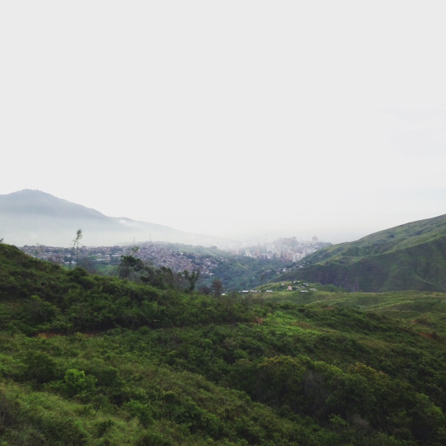
(PS. the main photo was taken on a misty morning run up to Pinchindé)




Do you think it’s safe for a women alone (small blonde canadian) to run alone in the mountain ? I’m heading to Cali tonight for a 3 weeks yoga retreat and would love to keep running over there !
thanks for your answer 🙂
Always better to run with a partner. But on the 3 Crosses you’ll be just fine alone as well. There are police all over the mountain until about noon every day.
I am training for a marathon and will be visiting Cali on a week that I have to run 15 miles. Where do you recommend that is safe and does not have to many hills? Also do you know of any groups that I could probably run with?
PM sent, but may be worth repeating here – the best flat places to run in Cali are:
– Along the river towards the zoo, on both the Santa Rita and Santa Teresita side.
– In Pance, along the river
– Parque del Ingenio, although more laps are needed
– If you follow Avenida 1N then once you get out of the city (towards the airport), there is a bike lane which is great for running/rollerskating and biking.
– Canchas Panamericans have some soccer courts that can be used to run around
– Ciclovia Sundays from 8 AM to 1 PM where many streets get blocked for cars – see map here.
Several of the gyms have groups that go running, SportLab is Grananda is famous for it. Also make sure to check out facebook groups.
We have an apartment off of Canas gordas close to turn for Pance. I run for 2-3 hours 3xwk at parque de salud and thebtrails and dirt roads by Voragine. We are coming down in January until April. If you ever want to run together please let me know.